Census 2011
District population : 24,54,196
Growth : 17.97%
Sex Ratio : 928
Literacy : 77.26

Brief About Latur District
HISTORICAL BACKGROUND OF LATUR
Latur district has an ancient historical background. The King
'Amoghvarsha' of Rashtrakutas developed the Latur city, originally
the native place of the Rashtrakutas. The Rashtrakutas who succeeded
the Chalukyas of Badami in 753 A.D called themselves the residents
of Lattalut
GEOGRAPHICAL POSITION AND PHYSICAL FEATURES
T he Latur District is in the south-eastern part of the Maharashtra
state. Latur town is situated on the 18.7° latitude and 73.25°
longitude. The district is situated on the Maharashtra Karnataka
boundary. On the eastern side of the Latur is Bidar district of
Karnataka, whereas Nanded is on the northeast, Parbhani on the
northern side, Beed on the Northwest and Osmanabad on the western
and southern side
The entire district of Latur is situated on the
Balaghat plateau, 540 to 638 mtrs from the mean sea level
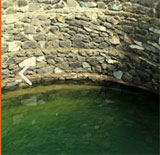
RIVERS AND TRIBUTARIES
Manjara is the main river which flows on the Balaghat plateau
along with its tributaries: Terna, Tawarja and Gharni.
The other three tributaries of Manjara are Manyad,
Teru and Lendi which flow on the northern plains.
Manjara : This is the main river. Its origin
is near the Gaukhadi Village of Beed district. The river flows
from the nothern boundaries of the Osmanabad district and cutting
across the Latur district goes to Karnataka State
Terna : This is the main tributary of Manjara
which flows on the southern boundary of the Ausa taluka .
Manyad : This river takes its origin at Dharmapuri
in Beed district and flows through the Ahmadpur taluka into Nanded
district
Lendi : The river has its origin in Udgir taluka
and flowing through the Ahmadpur taluka joins the Tiru river in
Nanded district .
Gharni : The river has its origin near Wadval
and flows through Chakur taluka.
Tawarja : Tawarja originates near Murud in Latur
taluka and joins the Manjara river at Shivani on the Latur-Ausa
boundary